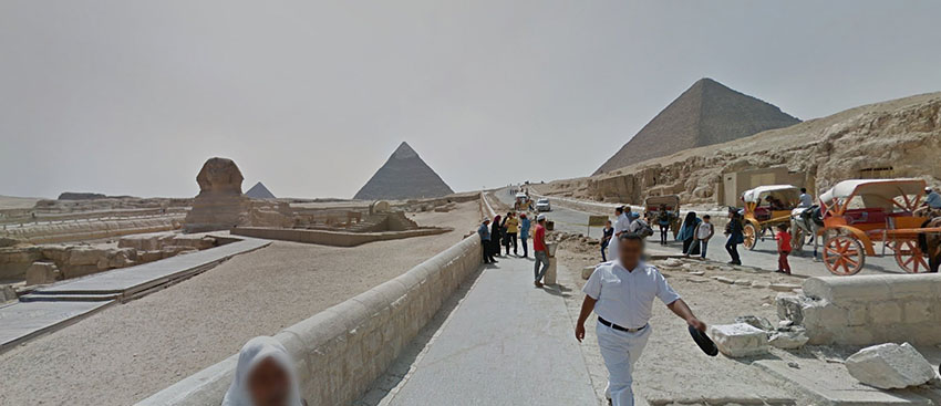
 Seeing the article in Time about Google’s unveiling of Street View Egypt in Google Maps, and its latest step in its quest to image and map the seven wonders of the world, I took a look. Not having traveled to see the pyramids of Giza form myself yet, unsure as to whether I would be able to enter all of the complex and get to see certain features up close, the street map idea from Google is excellent to show their situation and location in a real, everyday light. So often we are presented with views of the Giza complex that are idealised and aesthetically pleasing when photographs are carefully composed. The result can be visually very awe inspiring, though distances the subject from its reality. In Google’s Street View, we see a reality taken with an objective eye, a robotic lens. It is important to see things as they are and to see more accurately what it is we are are looking. I found the The Street Map Egypt in Google important in this regard.
This new collection images from Google Street maps includes 360-degree views of the Great Pyramids of Giza, the necropolis of Saqqara, the Citadel of Qaitbay, the Cairo Citadel, the Hanging Church and the ancient city of Abu Mena.